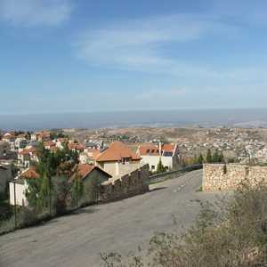
 | Har Adar is an Israeli settlement and local council in the Seam Zone and the Maccabim sub-region of the West Bank. Founded in 1986, it had a population of 4,058 in 2017. It is located near Abu Ghosh and the Green Line on Road 425, approximately 15 kilometers west of Jerusalem. Har Adar is ranked high on the Israeli socio-economic scale, at 9/10. Har Adar was initially built adjacent to the Green Line but is now largely located within the West Bank. The international communit
wikipedia.org |
|